Friday, December 15, 2017

Open House Saturday Dec 16 from 10:00 to Noon - Listed at $600,000


Quiambaug Cove Professional Center
Suite 105
107 Wilcox Road / US RT 1
Stonington CT 06378

eXp State Office
15 N Main St
Suite 100
W Htfd CT 06107

Thursday, December 14, 2017

Groton Neighborhoods - Groton Bank


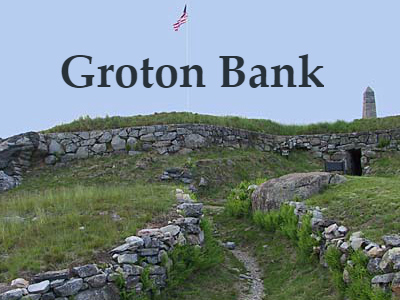
What is Groton Bank? Groton Bank is a historic village on the east bank of the Thames River in Groton, Connecticut. Geographically it comprises less that a half square mile--about 1 % of the Town of Groton and about 10% of the Town's major subdivision, the City of Groton.

Today the Groton Bank neighborhood contains a few hundred houses, three churches, a library, two museums, a Revolutionary War fort and business structures dating primarily from Colonial times to a century ago.

Groton Bank and Fort Griswold are separate but adjacent Historic Districts listed on the U.S. Department of the Interior's National Register of Historic Places.


Historic Village of Groton Bank
scan0001.jpg
Soule, Ellis and Beers, 1868 Atlas of New London County Connecticut

In 1655 the ferry operator Cary Latham became the first permanent English settler on the east bank of the Thames River when it was part of the Pequot Colony, later to become New London. After Groton became a separate town in 1705 the east bank of the river became known as Groton Bank and grew to become a major village in the town. In centuries following, Groton Bank became a national and world leader in shipbuilding, site of the only major Revolutionary War battle in Connecticut (Sept. 6, 1781), active in West Indies trade, the key defense (Fort Griswold) of the Thames Harbor and Connecticut in the War of 1812, a transportation hub, the town’s early center of business and commerce, home to the most famous captains of the whaling era as well as other prominent sea captains, and the residence of many leading citizens including a congressman.

Early Groton Bank history is intertwined with New London’s—many famous whaling captains and others sailing from New London harbor and a number of New London’s prominent businessmen resided at Groton Bank. Beginning in 1881 part of Groton Bank began to take on the name Groton Heights in honor of the 100th anniversary of the Revolutionary War Battle of Groton Heights fought here on September 6, 1781. In 1903 Groton Bank’s progressive residents were key to establishing the much geographically larger Borough of Groton, now the City of Groton and use of the name Groton Bank declined until 1970 when residents founded the Groton Bank Historical Association and began to revive the area and it history.


Today Groton Bank retains its village character of earlier times with a spectrum of village architectural styles including Colonial; Federal; Greek Revival; Victorian with its sub-styles of Italianate, Mansard, Carpenter Gothic, Stick style, Queen Anne, and Cottage style; Shingle style; Old English; English Tudor; Romanesque; and Neo-classical—all in an area of only about a dozen square blocks. Many of these structures retain their original appearance. Since Groton Bank’s 19th century residents were prosperous some of them enlarged or added “modern” features to their earlier era houses. For example, some colonial and Greek Revival houses have later additions or embellishments such as Victorian bay windows or porches.

Source: http://www.grotonbankha.com/

Wednesday, December 13, 2017

Groton Real Estate Market Report from Bridget Morrissey


The Groton Real Estate Market Report is a monthly statement of the median sales price for homes, the number of sales, the average price per square foot for homes, the number of homes for sale, and the average listing price of Groton homes for sale.


Groton was established in 1705, when it separated from New London, Connecticut.


The neighborhoods include Burnett's Corner, Center Groton, City of Groton, Groton Heights or Groton Bank, Groton Long Point, Long Hill, Mystic (06355) — primarily in the neighboring town of Stonington, but a small portion (West Mystic) is in Groton, Noank, Old Mystic, Poquonock Bridge, Fort Hill and Conning Towers-Nautilus Park or the Submarine Base area.


Groton is the home of General Dynamics Electric Boat Division, which has been supplying the Navy with submersibles since 1899. Electric Boat employs thousands in the Groton/New London area.

The Old Mystic Baptist Church, founded in Groton, was the first Baptist church in Connecticut.
CLICK HERE FOR THE GROTON REAL ESTATE REPORT


Tuesday, December 12, 2017

Pawcatuck Neighborhoods - Lower Pawcatuck


Lower Pawcatuck is a part of Stonington encompassing the area along the southerly portion of the Pawcatuck River to Little Narragansett Bay.

For information on Stonington homes for sale call or text the Bridget Morrissey Team at (860) 857-5165.


Monday, December 11, 2017

Gales Ferry Real Estate Market Report from Bridget Morrissey


The Gales Ferry Real Estate Market Report is a monthly statement of the median sales price for homes, the number of sales, the average price per square foot for homes, the number of homes for sale, and the average listing price of Gales Ferry homes for sale.


Gales Ferry is a village in the town of Ledyard, Connecticut. Gales Ferry is located along the eastern bank of the Thames River. The village developed as a result of having a ferry to Uncasville located at this site, and from which the village was named.

The Gales Ferry community has several neighborhoods, including The Village, Birdland, Christy Hills, Sherwood Forest, Glenwoods, and Presidential Estates.

The ferry which gave its name to the surrounding community of Gales Ferry was first established on the Thames in 1740. John Comstock, Ralph Stoddard, Jr. and John Hurlbut were the original three ferry men. It became known as Gale's Ferry when it was owned by Roger Gale from 1759 to 1764.

The ferry landing site at Gales Ferry (41°25′50.41″N 72°5′36.06″W) at 2 Riverside Place, is now occupied by a complex of buildings owned by Yale University which serve as a training camp for the Yale Heavyweight Men's Crew for the Harvard–Yale Regatta. The complex consists of the Varsity House, Manager's House and the Boathouse.
CLICK HERE FOR THE GALES FERRY REAL ESTATE REPORT


Sunday, December 10, 2017

Pawcatuck Neighborhoods - Clarksville


Clarks Village, or Clarksville, as it is also known, stretches from Pawcatuck Avenue by the Pawcatuck River to Greenhaven Road in Pawcatuck, a part of Stonington CT.

For information on Stonington homes for sale call or text the Bridget Morrissey Team at (860) 857-5165.


Saturday, December 9, 2017

Pawcatuck Real Estate Market Report from Bridget Morrissey


The Pawcatuck Real Estate Market Report is a monthly statement of the median sales price for homes, the number of sales, the average price per square foot for homes, the number of homes for sale, and the average listing price of Pawcatuck homes for sale.


Pawcatuck is a village in the town of Stonington which is located in New London County on the coast bordering Rhode Island. The population was 5,624 at the 2010 census. It is located across the Pawcatuck River from Westerly Rhode Island.


The Mechanic Street Historic District is on the National Register of Historic Places includes sites of shipbuilding, mills, and worker housing in a 147-acre area.

CLICK HERE FOR THE PAWCATUCK REAL ESTATE REPORT

Pawcatuck includes the neighborhoods listed below: