
Friday, April 28, 2017
What is your home worth compared to others in your neighborhood?
Thursday, April 27, 2017
Westerly Real Estate Market Report April 2017 from Bridget Morrissey
The Westerly Real Estate Market Report is a monthly statement of the median sales price for homes, the number of sales, the average price per square foot for homes, the number of homes for sale, and the average listing price of Westerly homes for sale.n

According to Wikipedia, Westerly becomes a large tourist attraction during the summer months during which the population nearly doubles.

From east to west, well-known beaches include Weekapaug Beach, Westerly Town Beach, Misquamicut State Beach, East Beach and Watch Hill Beach.

Weekapaug is a Native American word meaning "end of pond". Niantics, Pequots, and Narrangansetts lived in this area before early settlers arrived.

Misquamicut Beach is a three-mile length of beach that extends westward from Weekapaug to Watch Hill and separates Winnapaug Pond from the Atlantic Ocean.

Watch Hill is an affluent coastal village in the town of Westerly, Rhode Island. It sits at the most-southwestern point in all of Rhode Island, excluding Block Island. Watch Hill came to prominence in the late 19th and early 20th century as an exclusive summer resort, with wealthy families building sprawling Victorian-style "cottages" along the peninsula.
Watch Hill is characterized by the New York Times as a community "with a strong sense of privacy and of discreetly used wealth", in contrast with "the overpowering castles of the very rich" in nearby Newport.
Today, Watch Hill is best known as the backdrop for the Ocean House, the only Forbes Five-Star and AAA Five Diamond Hotel in Rhode Island.

Wednesday, April 26, 2017
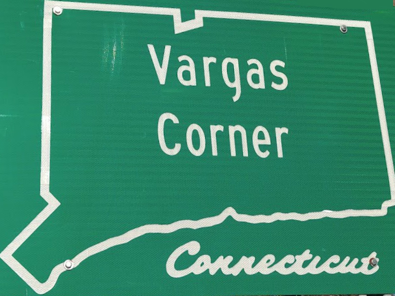
Vargas Corner
By Elizabeth Wood
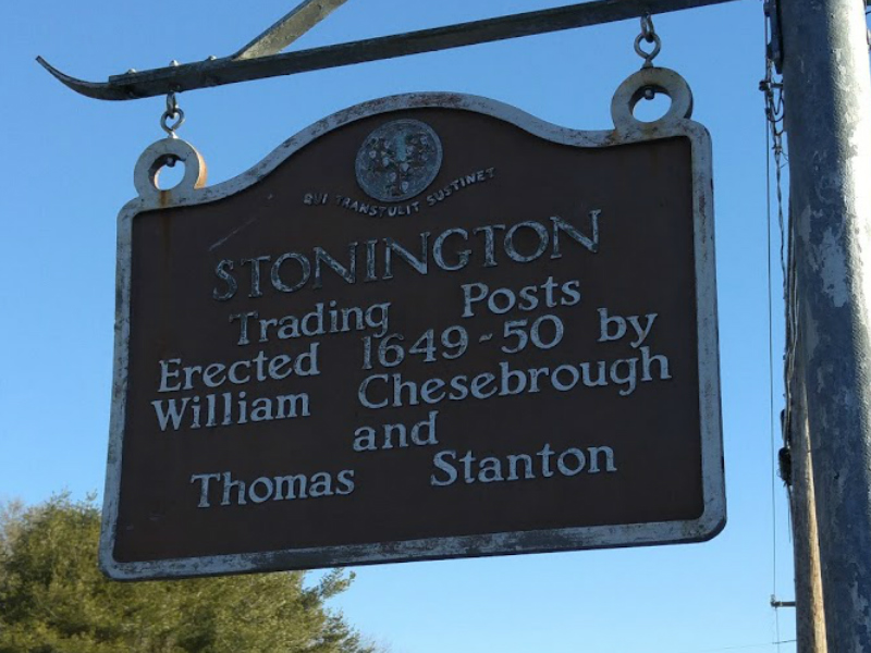
Stonington Historical Society
You may have always referred to the corners of Route 1, Flanders Road, and North Water Street as the “Shell Station” intersection, but with the recent installation of three signs, we now know that we should be calling it “Vargas Corners.”
The Historical Society was recently asked if we know anything about this and as a matter of fact, we do.
On the Connecticut State Library’s website is a page of Connecticut’s unique place names, including Vargas Corners. While some of the Stonington names on this list commemorate notable residents (perhaps a future post) like Downerville, Stillmanville, and Greenmanville, others have their origins in Native American place names like Wequetequock, Quiambaug, and Taugwonk. As you may have guessed, Vargas Corners is named for the accomplished family whose descendants still make their home there.
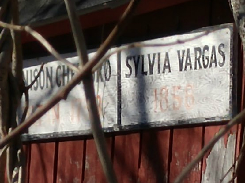
The appellation Vargas Corners likely happened sometime after 1874. In 1857 Francis Sylvia purchased a parcel of land adjacent to this intersection from the estate of Charles H. Smith “... commencing at the road leading to Stonington near the Grandison Chesebro House ...”
The Chesebro homestead can be seen on this 1854 New London County map from the Connecticut State Library. Francis, one of the first Portuguese emigrants to settle in Stonington, had arrived from the Azores around 1840 on a whaling ship.
In 1874 the name Vargas first appears at the wedding of Francis’ daughter, Ellen Sylvia and Joseph Vargas. Sylvia and his son-in-law soon went into business together as the Sylvia & Vargas Ice Dealers. Joseph Vargas had arrived in the United States sometime around 1853, also from the Azores, although he didn’t settle down immediately in Stonington.
He rode across the country on a donkey to participate in California Gold Rush, joined the U.S. Navy, served in the Civil War, and operated a local shoe store before joining his father-in-law in the local ice business. According to Stonington Ice: The Story of Sylvia & Vargas, 1874-1947, published by the Stonington Historical Society, “Between 1875 and 1882, they bought land parcels of the Grandison Chesebrough estate which included the homestead, now known as the red barn, 12 acres of land and a pond from A. H. Rathbone and his wife.”
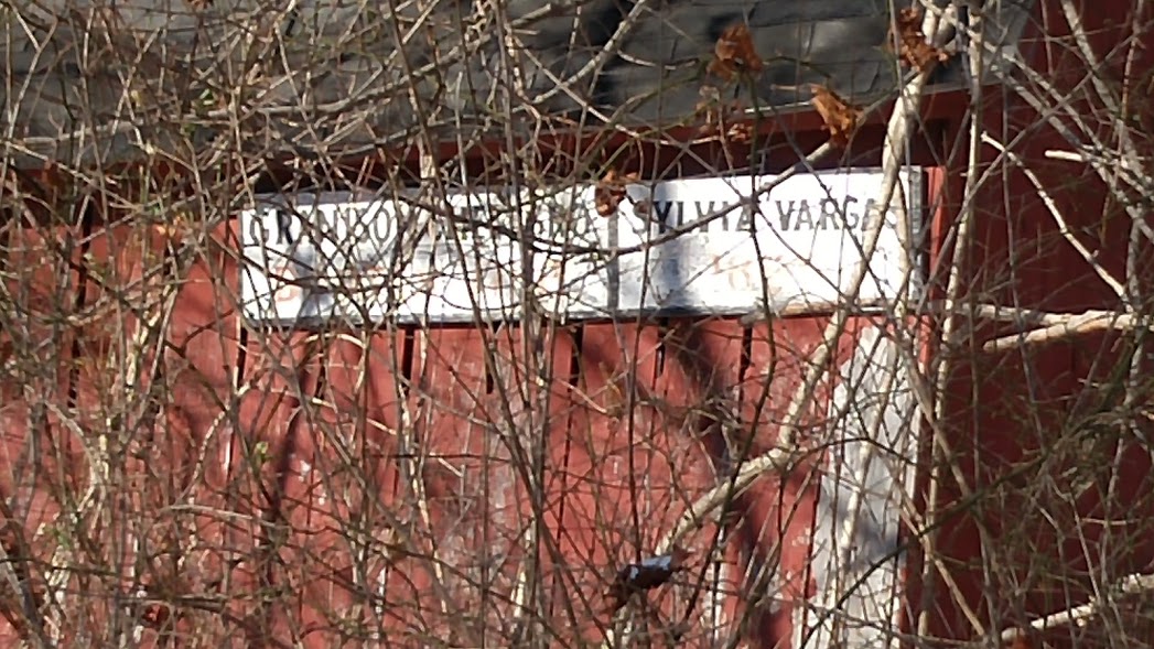
Many residents will remember this red barn with the sagging roof that marked the intersection long before the Shell station. The Sylvia and Vargas families owned great swathes of land that contained two ice ponds fed by Stony Brook. You can see the ponds here. Vargas pond is located just off Flanders and Sylvia’s Pond is closer to North Main Street.
In 1897 Joseph Vargas acquired the ice business after the death of his father-in-law and owned it until his death in 1916. His sons, Frank and Joseph Vargas, continued to operate the business as Vargas Bros., Ice Dealers until 1947. Many Vargas family descendants still make their home at this intersection including the Vargas, Connerton, and Connelly families. Stonington Ice is available from the Stonington Historical Society for $20 and was written by Joseph Vargas III. It is a plainspoken history that details a Stonington family and an industry that disappeared with the introduction of electric refrigeration.
The name “Vargas Corner” may not be remembered by many with the exception of Stonington’s volunteer firefighters. Ever since the days they announced by horn the location for volunteers to assemble, that intersection has been known as Vargas Corner and not the Shell station.
As seen in Stonington Patch at http://snip.ly/e5ji3
Tuesday, April 25, 2017
Ledyard Real Estate Market Report April 2017 from Bridget Morrissey

The Ledyard Real Estate Market Report is a monthly statement of the median sales price for homes, the number of sales, the average price per square foot for homes, the number of homes for sale, and the average listing price of Ledyard homes for sale.

According to Wikipedia,the principal communities of Ledyard are Ledyard Center (also known as Ledyard Village) and the Gales Ferry section (including Christy Hill Estates, Devonshire Estates, Ferry View Heights, Glenwoods, Pheasant Run, Sherwood Forest, and Woodridge Estates).
Other minor communities and geographic areas are Aljen Heights, Barrett Park, Colonial Manor, Cranwood Homestead, Highlands, Lakeside, Lantern Hill, Long Pond, Parsonage Hill Manor, Presidential Estates, Quaker Town, and Stonehenge.
The town also contains the Mashantucket Pequot Reservation, in the northeastern corner of the town.

Ledyard Center is located at the crossroads of 2 state highways: routes 117 and 214. It is home to Ledyard Town Hall and is one of the main commercial areas in the town. Every year in September, the fairgrounds host the popular Ledyard Fair, bringing families to the area for the weekend to enjoy carnival rides, entertainment and agricultural competitions.

Gales Ferry is centered around Route 12 and is one of the main commercial corridors in the town. The area is largely residential and contains 2 national register historic districts, a post office and library. It does offer typical neighborhood commercial services.
Each year in June, the Yale-Harvard regatta brings rowing teams and spectators to the riverfront and life to each school’s boathouse, both of which are located in the village.


Monday, April 24, 2017
Westerly Neighborhoods – Dunn’s Corners
Dunn's Corners in Westerly RI has it made with shopping and close proximity to the famed Misquamicut Beach for swimming and boating. There are plenty of baseball fields and golf courses close byand a wide variety of restaurants to choose from as well.
The train station is downtown but the Westerly State Airport is in the neighborood. It serves several roles for the South County area, including corporate aviation service, extensive aircraft maintenance and repair and regularly scheduled air passenger service to Block Island.
Sunday, April 23, 2017
South Kingstown Real Estate Market Report April 2017 from Bridget Morrissey

The South Kingstown RI Real Estate Market Report is a monthly statement of the median sales price for homes, the number of sales, the average price per square foot for homes, the number of homes for sale, and the average listing price of South Kingstown homes for sale


Saturday, April 22, 2017
Stonington Neighborhoods – Taugwonk
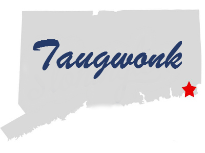
According to the Stonington Historical Society "Taugwonk: Stone mortar for pounding corn. Tagwouncke (Thomas Minor, 1662)." The name might be for a tool but the neighborhood is for those with a zest for life!
Stonington Vineyard, known for its Chardonnays. is at one end of Taugwonk Road before it crosses over RT 184 and becomes Jeremy Hill Road
Heading south down the road you will come to the US Coast Guard Foundation and Stonington Country Club. The club encompasses 155 acres of rolling hills and meadows.
Many capes and colonials sit on land at least 2 acres in size but more often than not on lots 4 - 10 acres. As you continue south the road goes under I-95 and becomes the continuation of Pequot Trail.
Subscribe to:
Posts (Atom)